


What Is OnTheGoMap and Why Is It So Popular?
OnTheGoMap is a free, user-friendly, and interactive route-mapping tool designed primarily for runners, cyclists, hikers, and walkers. It allows users to plot routes on a global map while instantly calculating distance, elevation, and estimated travel time. Whether you’re training for a marathon, planning a scenic hike, or creating a daily walking loop, OnTheGoMap makes route planning simple and accurate.
What sets it apart is its ability to snap to roads and trails, offering real-world accuracy instead of vague straight-line estimates. This makes it incredibly useful for those who want precision—whether you’re calculating calories burned, elevation gain, or time needed for a ride.
It’s become a favorite among fitness enthusiasts, travel bloggers, and even urban commuters looking to make the most of their daily movement. And best of all? It’s accessible via any browser—no app download required.
How to Use OnTheGoMap: A Beginner’s Guide
Getting started with OnTheGoMap is incredibly easy—even if you’re not tech-savvy. Here’s a quick step-by-step guide:
-
Visit onthegomap.com.
-
Click on the map to drop your starting point.
-
Keep clicking to add more points; the route automatically snaps to roads/trails.
-
Choose your activity: run, walk, cycle.
-
The map updates in real-time with distance, elevation, and route details.
-
Share, download, or export the route as GPX or embed it into a blog.
This intuitive process is what makes OnTheGoMap so appealing. It’s clean, fast, and incredibly responsive—whether you’re planning a 5K loop or a 200-mile road trip.
Top Features That Make OnTheGoMap Stand Out
While there are many route planners out there, OnTheGoMap offers some standout features:
-
Snap-to-path accuracy for trails, sidewalks, and streets
-
Elevation profile charting in real time
-
Multiple mode support: running, walking, biking
-
Distance and pace calculator
-
Export options (GPX, KML, or shareable link)
-
Browser-based access with no login required
These features make it not just a planning tool, but a performance optimizer. Athletes can plan based on incline, distance, and terrain—saving time and avoiding surprises.
Why Runners and Cyclists Love OnTheGoMap
Ask any runner or cyclist and they’ll tell you: route planning can be frustrating. You want to know exactly how far your route is, how hilly it is, and whether you’re going to hit heavy traffic areas. That’s why OnTheGoMap is a game-changer.
It’s especially useful for:
-
Long-distance runners mapping marathon or half-marathon training routes
-
Cyclists looking to avoid steep climbs or overly busy streets
-
Casual joggers wanting to stick to sidewalks or park trails
With OnTheGoMap, you can visualize your workout before you even lace up. It also helps in building varied training routines by easily adjusting routes with a few clicks.
Elevation Gain Matters: How OnTheGoMap Tracks Terrain
One of the most powerful features of OnTheGoMap is its real-time elevation chart. As you map your route, a dynamic elevation profile updates beneath the map. This gives you:
-
Total elevation gain
-
Highest and lowest points
-
Visual grade representation
Whether you’re training for a trail run or planning a bike ride in hilly terrain, knowing elevation in advance helps in strategy and pacing. No more unexpected uphill climbs halfway through your route!
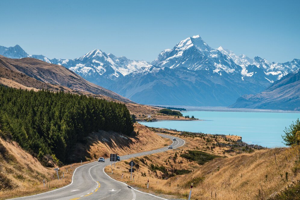
Using OnTheGoMap for Hiking and Walking Adventures
While many associate OnTheGoMap with urban fitness, it’s just as effective for outdoor hikers and walkers. Its path-snapping feature works with trails and footpaths, making it ideal for:
-
Mapping out national park hikes
-
Planning nature walks
-
Estimating walk times for urban exploration
-
Tracking step goals across scenic routes
Hikers can export their route in GPX format to use with GPS watches or mobile trail apps. That means no getting lost, even off the grid.
Comparing OnTheGoMap with Strava, Komoot, and MapMyRun
So how does OnTheGoMap stack up against other popular tools like Strava, Komoot, or MapMyRun?
| Feature | OnTheGoMap | Strava | Komoot | MapMyRun |
|---|---|---|---|---|
| Free to use | ✅ | Limited | ❌ | Limited |
| Snap-to-path | ✅ | ✅ | ✅ | ✅ |
| Elevation Profile | ✅ | ✅ | ✅ | ✅ |
| No sign-up needed | ✅ | ❌ | ❌ | ❌ |
| Export GPX/KML | ✅ | ✅ | ✅ | ✅ |
While platforms like Strava and Komoot offer rich community features and tracking, OnTheGoMap wins for simplicity, privacy, and ease of use—no accounts, no fees.
Tips and Tricks for Maximizing OnTheGoMap Usage
Here are some pro tips to make the most of OnTheGoMap:
-
Use “Undo” (Ctrl+Z) to quickly correct mistakes
-
Zoom in to get detailed footpath or trail options
-
Switch activity mode to change snapping behavior
-
Copy your route link to share with friends or save it for later
-
Combine it with Google Street View for visual recon of your route
Want to plan a scenic route? Use OnTheGoMap alongside Google Maps to spot parks, lakes, or city landmarks and incorporate them into your training.
Can OnTheGoMap Be Used for Travel and Road Trips?
Absolutely! While originally designed for fitness use, OnTheGoMap is great for:
-
Planning road trips with scenic stops
-
Estimating driving distances
-
Creating walking tours in new cities
-
Mapping out bikepacking adventures
Unlike Google Maps, which often reroutes or limits custom pins, OnTheGoMap lets you manually control every twist and turn—perfect for custom itineraries and off-the-beaten-path routes.
Final Thoughts: Why OnTheGoMap Should Be in Every Explorer’s Toolkit
Whether you’re training for your first 10K, exploring a new city, or just want a fun walking route near home, OnTheGoMap offers power and simplicity in one beautiful interface. It’s free, intuitive, and incredibly versatile.
For anyone who moves—walkers, runners, cyclists, hikers, travelers—OnTheGoMap is more than a tool. It’s your personal path planner, adventure designer, and fitness enhancer, all in one tab.

